Glacial Features (overview)
The following page exists to help explain the top secret information disclosed in the next page (Local Geology).
As its been made clear, surface geology in the LSRHS area and New England in general is dominated by features created by glaciers, and specifically the Laurentide Ice sheet as it retreated. This creates depositional features including drumlins, moraines, kames, kettles, eskers, and outwash plains.
Glaciers pick up and transport a huge load of debris as they advance. When they retreat, this debris is deposited where the ice melts (Tarbuck 163). The topography of the area we investigated is made up of mostly glacial depositional features, as is the topography of most of beautiful New England as well.
Drumlins
 Your average drumlin. (Note: Not in local area. Photo used for clarity.) (www.geo-logic.org)
Drumlins are short (avg. 50-200 feet high) asymmetrical hills that are usually 1/4 - 1/2 a mile long (Tarbuck 168).They are composed of non stratified till and are the result of glacial deposits. They always have one steep side that faces the direction that the glacier came from and a gentle side that faces away from it. They are formed from till being bulldozed by ice sheets which creates the steep side. The gentle side is created from till being deposited after the glacier makes it over the steep side. Drumlins are usually found in clusters called drumlin fields (Hansen).

The gentle side of a drumlin (feat. Teddy)...
|
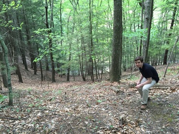
Compared to the steep side of a drumlin (feat. Carl)
|
Kames
Kames are another type of small hill formed by glacial deposition. However, unlike drumlins, they are round when seen from above and steep on all sides. They are made of sediment that is stratified. They are stratified because they are formed when glacial meltwater washes sediment into openings and depressions in the terminus (end) ice of a glacier. When the ice melts away, the mounds of sediment are left. Because they are carried by water, the sediment can sort itself, which leaves the kames stratified (Tarbuck 168)
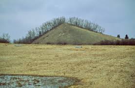
An example of a kame deposited by the Laurentide ice sheet. (Note: Not in local area. For reference only)
(www.geo-logic.org)
Kettles
Kettle lakes are shallow small-medium sized ponds formed by depressions made by retreating glaciers (wow, another one!). As a glacier retreats, blocks of ice break off and eventually get buried in the ground. When they melt, they form depressions in the sediment. These pits are usually no larger than 1 mile in diameter and 30 feet deep. Eventually, they are filled with water and become kettle lakes/ponds, like Walden Pond.
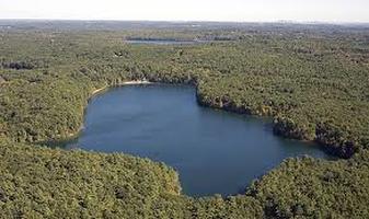
We have glaciers to thank for the great works written here at Walden Pond by Henry Thoreau, a kettle lake. I guess you could say that that ice block had some Civil Disobedience from its ice sheet.
